Search Results
80 results found with an empty search
- The Impact: Drone Service Companies & Strategic Planning
By 2025, the global drone services market is valued at over $30 billion , with forecasted annual growth rates exceeding 31% as industries rapidly integrate drone solutions for operational efficiency, compliance, and data-driven insights. This remarkable expansion underscores how drone services are becoming integral to modern business strategies across agriculture, construction, infrastructure, logistics, and beyond. Key Takeaways Drone services now exceed $30 billion globally , growing over 31% annually as industries adopt drones for data collection, inspections, logistics, and creative production. AI-powered automation, LiDAR, and BVLOS capabilities are redefining efficiency and safety across agriculture, construction, and infrastructure management. Regulatory progress and NDAA-compliant technology are accelerating adoption in logistics, insurance, and environmental monitoring sectors. By 2034, the drone services market could reach $550 billion , marking drones as essential tools for strategic planning, sustainability, and digital transformation. 1. Transforming the Agriculture Landscape The agricultural drone market surpassed $4-5 billion globally in 2025 , with adoption rates soaring as farms embrace automation and AI analytics. Drones are no longer used solely for imaging; they now perform precision spraying, pathogen scouting, soil LiDAR mapping, and multispectral imaging to detect stress and optimize yield. Major U.S. cooperatives and agritech firms deploy fleets that autonomously monitor crop health and adjust flight patterns based on real-time weather and soil data. This AI-enhanced precision agriculture reduces input waste, boosts yield predictability, and supports sustainability through targeted irrigation and pest control. By integrating drone analytics into farm management software, the agricultural sector has achieved a new level of data-driven farming efficiency - a cornerstone of the global shift toward smarter food production. 2. Construction and Surveying In 2025, the global construction drone market exceeds $5 billion , with widespread use in surveying, inspection, and progress documentation. Modern construction drones integrate autonomous mapping, real-time 3D modeling , and direct BIM (Building Information Modeling) data syncing, allowing teams to plan and execute projects with unparalleled precision. Contractors increasingly prefer NDAA-compliant hardware and secure, U.S.-approved flight software to meet federal and municipal procurement standards.LiDAR-equipped drones now deliver centimeter-accurate models and terrain analyses in a fraction of the time traditional survey teams require — reducing costs by up to 60% and dramatically improving safety by keeping workers off hazardous terrain. 3. Infrastructure Inspections The infrastructure inspection market has surpassed $6 billion , fueled by regulations demanding Remote ID and expanding BVLOS (Beyond Visual Line of Sight) operations for bridges, power grids, and industrial assets. 2025’s inspection workflows incorporate thermal anomaly detection , full-LiDAR scans, and AI-based defect recognition to preemptively flag corrosion or structural stress.Cloud-synced inspection systems now allow engineers to assess damage remotely, generate automated reports, and comply with federal maintenance standards - all within hours instead of days. These innovations have made drones a core component of predictive maintenance and asset lifecycle management , reducing downtime and extending the lifespan of critical infrastructure. 4. Logistics and Supply Chain Operations The delivery drone market now stands at about $1.2 billion , growing more than 30% annually as companies expand automated delivery networks. Retailers like Amazon, Walmart, and Wing are piloting multi-city drone corridors , leveraging advanced UTM (Unmanned Traffic Management) systems to ensure safe and autonomous operations. The introduction of drone-in-a-box deployments - self-charging bases that dispatch and recover delivery drones - has redefined last-mile logistics.Drones are now integral in inventory auditing , warehouse monitoring , and pharmaceutical logistics , particularly for time-sensitive deliveries in congested or remote areas. As urban logistics evolves, drones are reshaping how businesses perceive mobility and responsiveness within their supply chains. 5. Environmental Monitoring Valued at over $700 million in 2025, the environmental drone sector now plays a central role in climate resilience , carbon verification , and disaster recovery analytics . NGOs and research organizations deploy fleets equipped with hyperspectral sensors to track deforestation, pollution, and wildlife migration patterns with remarkable accuracy. Drones are also key to verifying carbon offset projects , assessing reforestation progress, and supporting post-disaster assessments after floods and wildfires.This shift toward data-backed environmental intelligence enables more transparent sustainability reporting and targeted conservation efforts. 6. Aerial Cinematography In 2025, 8K-capable drones with AI-assisted tracking , obstacle avoidance, and real-time streaming have become standard in the film and sports industries. Drone cinematography, valued above $600 million , empowers creators to capture dynamic aerial perspectives once impossible without helicopters or cranes. Production teams now integrate drones into previsualization workflows, using automated pathing and shot repetition to achieve perfect continuity.The creative partnership between drone operators and cinematographers has reshaped modern storytelling, while evolving airspace licensing and anti-drone regulations ensure safety at major events and film sets. 7. Search and Rescue Drones are indispensable in emergency response and humanitarian operations . The 2025 global market for SAR drones exceeds $800 million , driven by advances in AI swarm coordination , thermal imaging , and 5G-enabled command systems . Modern drones combine LiDAR, FLIR , and AI object detection to locate individuals faster and with greater accuracy - even in smoke, debris, or low-visibility conditions. In wildfire response, for example, drones map containment lines and track heat signatures to guide firefighting strategies. The result: faster rescues, reduced risk to responders, and enhanced coordination across agencies - a paradigm shift in how disasters are managed. 8. Insurance and Risk Management The insurance drone market has expanded beyond $2 billion , with leading insurers now relying on automated aerial platforms for risk evaluation , loss adjustment , and predictive claims analytics . Drones assess post-disaster property damage, inspect roofs, and verify compliance with new broadcast ID and data privacy mandates introduced in 2024. AI analysis of drone imagery accelerates claim processing and reduces fraud, enabling more equitable and efficient settlements for policyholders. By integrating aerial data into underwriting and risk modeling, insurers are setting new benchmarks for accuracy, transparency, and speed. 9. Security and Surveillance The security and surveillance drone market , valued at over $5 billion , continues to grow as both public and private sectors strengthen perimeter protection and event monitoring systems. Organizations deploy autonomous patrol drones capable of face and vehicle recognition, integrating with on-ground systems through real-time cloud analytics. Simultaneously, counter-UAV technologies have advanced, allowing secure detection and mitigation of unauthorized drones near airports, power facilities, and large gatherings. These advancements illustrate how drone service companies are redefining security strategy - merging surveillance with rapid response and risk prevention. Conclusion Drone services companies are no longer just data providers - they are strategic innovation partners driving transformation across virtually every major industry. From sustainable agriculture to autonomous logistics and cinematic storytelling, drones are enabling organizations to operate with greater intelligence, precision, and speed. As we move toward 2030 , global drone service revenues are projected to approach $110 billion , with long-term forecasts estimating over $550 billion by 2034 . With AI integration, regulatory harmonization, and automated fleet management on the horizon, the skies are not limits - but opportunities waiting to be explored.
- How Window Cleaning Drones Work
Window cleaning drones have revolutionized the building maintenance industry by offering a safer, more efficient, and cost-effective solution to cleaning windows, particularly on tall and complex structures. These drones, equipped with advanced cleaning systems, eliminate the need for scaffolding, ropes, and manual labor. Components of a Window Cleaning Drone Drone Cleaning Mechanisms Operational Workflow Advantages of Window Cleaning Drones Challenges and Limitations Future Developments Components of a Window Cleaning Drone Drone Frame and Structure The frame and structure of a window cleaning drone are designed to be both lightweight and durable. Made from materials like carbon fiber or high-grade aluminum, the frame must withstand the rigors of frequent use and exposure to the elements. The structure typically includes arms that extend outwards, housing the motors and propellers. Propulsion System The propulsion system is the heart of the drone’s movement capabilities. It consists of multiple motors and propellers that work in tandem to provide lift, thrust, and maneuverability. These components must be powerful enough to support the weight of the drone and its cleaning equipment, yet efficient enough to maximize flight time. Advanced drones often feature brushless motors, known for their durability and energy efficiency. Power Source Powering a window cleaning drone is typically a high-capacity lithium-polymer (LiPo) battery . These batteries offer a high energy density, providing longer flight times while keeping the weight manageable. Some drones also feature dual battery systems, which allow for extended operational periods and provide a failsafe in case one battery fails. Battery life can range from 20 to 40 minutes per charge, depending on the drone’s size and the complexity of the cleaning task. Navigation and Control Systems Modern window cleaning drones are equipped with sophisticated navigation and control systems, enabling them to operate autonomously or be piloted remotely. Key components include: GPS Modules : Provide accurate positioning and navigation, ensuring the drone can maintain a stable hover and follow predefined flight paths. Inertial Measurement Units (IMUs) : Measure the drone’s acceleration and rotation, helping maintain stability and orientation. Obstacle Avoidance Sensors : Utilize ultrasonic, infrared, or laser-based systems to detect and avoid obstacles, ensuring safe operation near buildings and other structures. Cameras : High-resolution cameras provide real-time visual feedback to the operator and assist in navigation and inspection tasks. Drone Cleaning Mechanisms Spray Systems One of the primary cleaning mechanisms of a window cleaning drone is its spray system. This system typically includes a tank for cleaning fluid, a pump, and nozzles that can spray the fluid onto the windows. The fluid can be water, detergent, or a specialized cleaning solution, depending on the task. The pump ensures a consistent flow of fluid, while the nozzles are designed to create a fine mist or a targeted jet, effectively loosening dirt and grime from the window surfaces. Brushes and Squeegees In addition to spray systems, many window cleaning drones are equipped with brushes and squeegees. These tools work in tandem with the spray system to scrub and wipe the windows clean. Brushes are often made of soft, durable materials that can scrub away dirt without scratching the glass. Squeegees, on the other hand, are used to remove the cleaning fluid and any remaining dirt, leaving the windows streak-free. Rotating Discs Some advanced window cleaning drones feature rotating discs equipped with microfiber pads or brushes. These discs spin at high speeds, scrubbing the windows as the drone moves. This mechanism is particularly effective for removing stubborn dirt and achieving a polished finish. Operational Workflow Pre-Flight Preparation Before deploying a window cleaning drone, several preparatory steps must be taken: Inspection : The drone and its components are inspected to ensure they are in good working condition. Battery Check : Batteries are checked and charged to ensure they have enough power for the task. Cleaning Solution Preparation : The appropriate cleaning solution is prepared and loaded into the drone’s tank. Flight Plan : A flight plan is created, taking into account the layout of the building, the areas to be cleaned, and any potential obstacles. Deployment and Navigation Once the pre-flight preparations are complete, the drone is deployed. Depending on the drone’s capabilities, it can either be piloted manually or operate autonomously. Autonomous drones follow a pre-programmed flight path, using GPS and sensors to navigate around the building and avoid obstacles. Cleaning Process As the drone approaches the windows, it activates its cleaning mechanisms. The spray system releases the cleaning solution onto the windows, while the brushes or rotating discs scrub away dirt and grime. The squeegees then remove the cleaning fluid, leaving the windows clean and streak-free. The drone moves methodically across the building’s surface, ensuring all areas are covered. Data Collection and Analysis During the cleaning process, the drone’s cameras and sensors collect data on the building’s condition. This data can be used for inspection purposes, identifying areas that require maintenance or repair. Some drones are equipped with thermal cameras, which can detect heat loss through windows, providing valuable information for improving a building’s energy efficiency. Post-Flight Procedures After the cleaning task is complete, the drone returns to its starting point. Post-flight procedures include: Battery Recharge : Batteries are removed and recharged for the next use. Cleaning and Maintenance : The drone and its components are cleaned and inspected for any signs of wear or damage. Data Review : Data collected during the flight is reviewed and analyzed, and any necessary reports are generated. Advantages of Window Cleaning Drones Safety One of the most significant advantages of using drones for window cleaning is the enhanced safety they provide. Traditional methods often require workers to operate at dangerous heights, posing a risk of falls and injuries. Drones eliminate this risk by performing the cleaning tasks remotely, keeping workers safely on the ground. Efficiency Drones can clean large areas quickly and consistently, often in less time than traditional methods. Their ability to reach difficult areas and clean thoroughly without the need for scaffolding or ladders makes them highly efficient. This efficiency translates to cost savings for building owners and maintenance companies. Cost Savings By reducing the need for equipment and labor, drones lower the overall cost of window cleaning operations. The initial investment in drone technology is offset by the long-term savings in labor costs and the increased efficiency of the cleaning process. Accessibility Drones can reach areas that are difficult or impossible to access with traditional methods, ensuring thorough cleaning of all surfaces. This capability is particularly beneficial for buildings with complex architectures or features like overhangs and recessed windows. Environmental Impact Drones can also contribute to a reduced environmental impact. They typically use less water and cleaning solution compared to traditional methods, and their ability to detect and address heat loss through windows can help improve a building’s energy efficiency. Challenges and Limitations Weather Conditions One of the main challenges of using window cleaning drones is their susceptibility to weather conditions. High winds, rain, and extreme temperatures can affect the drone’s performance and safety. Operators must carefully monitor weather conditions and plan cleaning tasks accordingly. Battery Life While advancements in battery technology have improved flight times, battery life remains a limitation. Drones can only operate for a limited time before needing to recharge, which can be a constraint for large-scale cleaning tasks. Some drones mitigate this issue with dual battery systems or quick-swappable batteries. Regulatory Compliance Operating drones, especially in urban areas, requires adherence to various regulations and guidelines set by aviation authorities. These regulations are designed to ensure the safety and privacy of the public. Operators must be knowledgeable about these regulations and obtain the necessary permits and certifications. Technical Skills Operating and maintaining window cleaning drones requires technical skills and expertise. Operators must be trained in piloting the drones, programming flight paths, and performing maintenance. This need for specialized skills can be a barrier for some companies looking to adopt drone technology. Future Developments Increased Autonomy Future window cleaning drones are expected to feature even higher levels of autonomy. Improved AI-driven navigation and obstacle avoidance systems will reduce the need for human intervention and enhance efficiency. Drones will be able to adapt to changes in the environment and optimize their cleaning paths in real-time. Enhanced Battery Technology Advancements in battery technology will lead to longer operation times, allowing drones to cover larger areas without needing frequent recharges. Solid-state batteries and other emerging technologies promise to deliver higher energy densities and faster charging times. Integration with Building Management Systems Integration with building management systems (BMS) will enable drones to operate as part of a comprehensive maintenance strategy. Drones will be able to receive cleaning schedules and maintenance updates directly from BMS, ensuring coordinated and timely operations. Improved Cleaning Mechanisms Future drones will feature more advanced cleaning mechanisms, including self-cleaning systems and the ability to carry multiple cleaning agents. These improvements will enhance the effectiveness and versatility of window cleaning drones, allowing them to tackle a wider range of cleaning tasks. Environmental Sustainability There will be a growing focus on environmental sustainability, with drones using eco-friendly cleaning agents and energy-efficient technologies. This will help reduce the environmental impact of window cleaning operations and contribute to overall sustainability goals. Conclusion Window cleaning drones represent a significant advancement in building maintenance technology. By combining advanced cleaning mechanisms with autonomous navigation and data collection capabilities, these drones offer a safer, more efficient, and cost-effective solution for maintaining clean windows on high-rise buildings and other complex structures. As technology continues to evolve, window cleaning drones will become even more autonomous, efficient, and environmentally friendly, paving the way for a new era in building maintenance. For businesses and homeowners alike, investing in window cleaning drones represents a smart move towards modern, sustainable building maintenance practices.
- Types of Drone Construction Site Photos
Drone construction site photography is no longer a niche luxury - it’s an essential service that spans operational monitoring, technical documentation, compliance, and marketing, each supported by authoritative academic and governmental research. Each type offers unique technical insights and business value, contributing to efficiency, safety, and better project outcomes. Key Takeaways Drone photography creates high-resolution visual records that support operational oversight, technical documentation, and regulatory compliance on construction sites. Frequent drone flyovers enable accurate, up-to-date progress tracking, while generating data-rich archives vital for validating milestones and resolving project disputes. Automated aerial imaging improves site safety by replacing risky manual inspections and allows project teams to detect issues early, resulting in quicker corrective action and reduced downtime. End-of-construction aerial photos elevate marketing efforts, providing unique, eye-catching visuals that showcase quality workmanship, build client trust, and strengthen branding for construction businesses. Construction Demolition Progress Photos Drones provide an ideal vantage point for capturing demolition progress, documenting every phase from initial structure removal to site clean-up. By capturing drone imagery, project managers can analyze the effectiveness of demolition techniques, monitor for safety compliance, and verify that demolition follows the intended sequence. Three-dimensional (3D) drone models, integrated with Building Information Modeling (BIM), are becoming critical in mapping out every demolition stage. These models enable real-time updates for stakeholders, facilitate seamless coordination between field crews and demolition planners, and contribute to regulatory compliance documentation. A major advantage is the ability to update demolition plans based on drone-acquired data, adjusting logistics and safety procedures proactively. Over time, this kind of ongoing documentation becomes a data asset, supporting sustainability initiatives and enabling compliance with increasingly rigorous governmental standards for waste management and recycling. Construction Site Earthwork Cut/Fill Photos Drone-based photogrammetry is transforming earthwork operations, especially cut and fill activities essential to preparing construction sites. By flying systematic patterns with drones equipped with multi-sensor payloads, surveyors can capture contour data, elevation models, and volumetric measurements with unmatched speed and accuracy. Compared to traditional ground-based methods, drone surveys can collect millions of data points per flight, yielding highly accurate topographical maps in a fraction of the time. The top-down and oblique imagery captured by drones allows for precise cut and fill calculations using advanced aerial analytics. These images are fed into software platforms that generate 3D terrain models, enabling detailed tracking of how much soil is being moved where - and how actual progress compares to initial earthwork designs. The real-time data sharing capabilities mean decisions about equipment allocation and workflow sequencing can be made based on current site conditions, not outdated survey results. Additionally, drone cut/fill data supports better documentation for compliance, billing, and dispute resolution, since every aspect of ground movement is photo and data-verified. This streamlines reporting for both contractors and clients, and supports sustainable grading practices by minimizing unnecessary rework. Construction Site Progress Photos Progress photography is one of the most established drone applications in construction. Drones capture recurring images from pre-programmed waypoints, documenting all visible project milestones and providing objective, timestamped records of site evolution. By leveraging photogrammetry, point cloud creation, and 4D BIM comparison , drone images now allow stakeholders to visualize not just the project's spatial development but also its alignment with the planned project timeline. These images support quality control, project documentation, and stakeholder communication in a way that manual photography simply cannot. Frequent aerial site documentation helps validate subcontractor claims, ensures accountability, and provides marketing-ready visuals for investors or municipal authorities. Where traditional ground-level progress photos are often limited by perspective or access, drones readily offer comprehensive roof-to-ground coverage - even in areas that are inaccessible or hazardous on foot. In more advanced workflows , drone photos are processed into 3D meshes and point clouds, which can be overlaid with BIM models to perform as-built versus as-planned comparisons. This process aids in early detection of defects or scheduling delays, making drone photography a core quality management tool in modern project management. Construction Site Structure Inspection Photos Structural inspection using drones introduces both safety and technical precision to construction workflows. Unlike manual inspection - which often involves hazardous ladders, scaffolding, or rope access - drone-mounted cameras can closely examine facades, roofs, bridges, and hard-to-reach areas at high resolution, often leveraging advanced sensors such as LiDAR and thermal imagers. These capabilities not only reduce inspection times but also improve defect detection, from microcracks to misalignments. Paired with artificial intelligence and machine learning, drone imagery can now automate preliminary defect detection , flagging anomalies in real-time for engineers reviewing inspection photos. Drone-driven structural inspections are now regularly integrated into preventive maintenance programs and compliance audits, offering a safer, faster, and more thorough alternative to traditional manual methods. Periodic drone inspections create an ongoing record of a structure's integrity throughout construction and post-construction operation. Data collected are often geo-tagged, annotated, and stored in project databases, fostering more transparent and accurate reporting to insurance providers, regulatory bodies, and project stakeholders. End of Construction Marketing Photos When a project is complete, marketing photography becomes a key value proposition of drone tech in construction. High-resolution aerial images and video provide developers, property managers, and marketing teams with dynamic perspectives, showcasing design features, landscaping, and site context impossible to capture from ground level. End-of-construction photos support multiple asset uses: website galleries, press releases, listing platforms, and even aerial walkthroughs for prospective buyers or tenants. Drone marketing images are crucial for demonstrating the quality and scale of the finished product, attracting investors, and supporting future business development. From a technical standpoint, drones enable planned, repeatable photo positions that allow perfect before-and-after comparison shots. Marketing teams increasingly demand drone media because it conveys a modern, innovative image of the firm, while offering tangible evidence of project delivery and quality assurance. A strong drone-captured portfolio differentiates construction businesses in competitive bidding environments and builds valuable visual archives for long-term branding. Conclusion Drone construction site photography has rapidly evolved from a specialty service into a core practice across the architecture, engineering, and construction sectors. By delivering unparalleled perspectives and actionable data, drones enhance every stage of the construction lifecycle - from demolition and earthwork to structure inspections, progress documentation, and high-impact marketing. This technology not only streamlines technical documentation, safety monitoring, and compliance reporting but also enables more precise planning and efficient resource allocation. As authoritative research confirms, the comprehensive visual records provided by drone imagery are reshaping project management, minimizing risk, and creating new opportunities for stakeholder engagement. Construction professionals who embrace drone-driven workflows can expect significant gains in safety, productivity, and project transparency for years to come.
- How Have Drones Transformed Construction in Recent Years?
In recent years, I’ve witnessed the construction industry undergo a dramatic change, largely due to the introduction of drones. These unmanned aerial vehicles have become indispensable, offering new levels of efficiency, safety, and accuracy that were simply unattainable before. From my experience in the field, drones are not just useful - they’re setting a new standard for project management across the sector. Why Are Construction Drone Services Growing So Quickly? Construction drone services have exploded in popularity because drones provide aerial views that were previously costly or too difficult to obtain. With high-resolution cameras and cutting-edge sensors, drones supply detailed images and data from high above, giving project managers and engineers an efficient and practical way to monitor progress, inspect structures, and survey land. These tools drastically reduce the time required for data collection . Whereas traditional methods might have taken days or weeks, drones complete essential surveying tasks in mere hours - potentially saving thousands in labor and keeping projects on track. Drones also make sites safer by decreasing the need for workers to enter hazardous or remote areas, enabling remote inspections of tall buildings or precarious terrain. What Are the Most Impactful Drone Applications in Construction? Drones play a critical role throughout every stage of a construction project. Here are some ways I’ve seen them deliver real impact: Site surveying and mapping: Drones deliver topographic maps and precise 3D models that support efficient planning and design , helping to catch problems before ground is broken. Progress monitoring: Frequent drone flights give stakeholders timely images and videos to monitor progress and compare against project milestones. Inspection and quality control: Drones can inspect roofs, facades, and foundations, spotting damage or defects early in the build. Material and inventory management: By surveying stockpiles , drones help streamline inventory tracking and minimize waste. Safety surveillance: Continuous aerial monitoring identifies unsafe conditions, supports better compliance, and strengthens overall job site safety. How Much Does It Cost to Hire a Drone for Construction Projects? Budgeting for drone services can depend on several factors: The type of drone and sensors needed, the frequency and duration of flights, the expertise of pilots, included data processing and analysis, and site location or accessibility. Typically, hiring a drone for construction costs between $150 and $300 per hour. Some providers offer package deals or project pricing, which may be more cost-effective for larger or longer-term needs. It’s always smart to seek transparent quotes and clear deliverables to avoid unwanted surprises on your invoices. What Are the Benefits of Drones Beyond Cost Savings? Drones don’t just make projects faster and cheaper, but smarter. Their detailed imagery and real-time data support more informed decisions and earlier risk management. For instance, having rapid access to site data lets teams spot structural problems before they escalate into costly repairs. Drones also improve communication: Visual data is easy to share among architects, engineers, and clients, building trust and helping secure quick approvals. They support sustainability , too, by reducing the need for heavy machinery and minimizing site disturbance - a growing priority on modern construction sites. How Should Teams Integrate Drones Into Their Workflow? Maximizing drone technology means embedding it effectively into daily processes. Based on my experience, here are the top recommendations: Partner with experienced drone providers to ensure skilled operations and accurate data. Train staff to interpret drone-generated data and integrate it with project management tools. Establish clear flight protocols, safety checks, and schedules. Leverage software platforms for analyzing drone footage and deriving actionable insights. Stay up to date and compliant with local regulations - including permits and privacy standards. What Does the Future Hold for Construction Drones? Looking ahead, the role of drones in construction will continue to expand. Advances in AI and machine learning mean drones will handle more autonomous tasks - from real-time hazard detection to automated progress tracking. Integrating drone data with Building Information Modeling (BIM) will make project oversight even more dynamic and collaborative, improving accuracy and cross-team communication. Staying adaptable and informed about these technologies is essential for maintaining a competitive edge and reaping the full benefits of drones in construction. Adopting drone technology is not just an option it’s a necessity for anyone serious about modern construction. The benefits in efficiency, safety, and data quality are clear, and those prepared to harness this technology will lead the way in innovative, successful project outcomes.
- The Impact of Drones on Real Estate Photography in 2025
In 2025, drones have become a transformative tool in real estate photography, offering unprecedented aerial perspectives, data-driven insights, and immersive virtual tours. The technology has shifted from being a niche luxury service to an essential part of modern property marketing. This article explores the current state of real estate drone photography, the market impact, technological innovations, regulations, financial considerations, and the future outlook. The Evolution of Real Estate Drone Photography Before drones, real estate photography was limited to static ground-level images. While traditional photos showcased interiors and facades, they often failed to capture the property’s full scale, lot layout, and surrounding neighborhood. Buyers lacked a holistic understanding of properties, particularly larger estates or commercial sites. Drones, equipped with high-resolution cameras and AI-assisted flight capabilities, now allow real estate professionals to create comprehensive visual narratives. By 2025, these tools are used not just for marketing, but also for inspections, mapping, and immersive tours. Key Technological Advancements in 2025 Extended Flight Times : Modern drones can fly 45–60 minutes per battery, covering large properties efficiently. 8K and 360-Degree Cameras : Drones such as the Antigravity A1 capture ultra-high-definition 360° footage for immersive virtual tours. AI-Assisted Flight Paths : Artificial intelligence optimizes flight routes, automatically adjusting for lighting, angles, and obstacles. LiDAR and Photogrammetry : Advanced sensors enable accurate 3D mapping of properties, useful for both marketing and professional architectural or surveying purposes. FPV (First-Person View) Fly-Throughs : Cinematic fly-throughs enhance engagement, offering a more dynamic perspective than traditional overhead shots. Market Trends and Economic Impact in 2025 The real estate drone services market is projected to grow from $0.49 billion in 2024 to $0.57 billion in 2025, reflecting a CAGR of 16.0%. Adoption is highest in luxury residential and commercial real estate markets, where visual storytelling is critical. Cost and ROI of Drone Services Residential Packages : Drone photography packages typically start at $249 for 10–15 aerial photos. Combined photo and video services range from $249–$499 ( HomeJab 2025 Pricing ). Luxury and Commercial Properties : High-end packages, including 3D mapping and FPV videos, can exceed $1,000 per project. Return on Investment : Zillow reports that listings with aerial imagery and 3D tours sell faster and at higher prices than standard listings ( Zillow 3D Home ). Regulatory Landscape in 2025 FAA Part 107 Certification In the United States, operating drones commercially requires a Remote Pilot Certificate under FAA Part 107 . Certification ensures operators understand airspace regulations, privacy laws, and safe operation practices. Compliance is particularly crucial in urban areas and near airports. Best Practices for Drone Photography in Real Estate Pre-Shoot Planning Property Scouting : Identify key features such as gardens, pools, driveways, and views. Optimal Timing : Schedule shoots during golden hours for the best lighting. Weather Considerations : Avoid rain, fog, or high winds. Equipment Recommendations Drones with 4K–8K cameras and gimbal stabilization High-quality batteries for extended flights FPV drones for cinematic videos LiDAR or photogrammetry sensors for 3D mapping Shooting Techniques Combine aerial shots with traditional interior photos for a complete visual story . Capture overlapping images for 3D reconstruction and floor plans. Use AI-assisted modes for consistent framing and exposure. Post-Processing Tips Maintain realism while enhancing colors and contrast Highlight unique property features Create virtual tours combining aerial and interior footage Advanced Applications Beyond Marketing Construction Progress Monitoring : Drones capture time-lapse and site overviews for developers. Roof and Infrastructure Inspections : High-resolution imagery identifies structural issues. 3D Mapping for Architects : Platforms like Autodesk Reality Capture allow precise 3D models and point clouds. Case Studies: Real Estate Drone Photography in 2025 Luxury Residential Properties Drones are now standard in luxury listings. Aerial and FPV fly-throughs significantly improve buyer engagement, emphasizing property scale and amenities. Commercial Real Estate Drones showcase office parks, retail centers, and industrial sites from unique perspectives, helping investors and tenants evaluate locations efficiently. 3D maps and thermal imaging add another layer of analysis for commercial decision-making. Future Outlook: The Next Frontier By the end of 2025 and beyond: AI Integration : Drones will fully automate flight paths, composition, and lighting corrections. VR/AR Immersion : Buyers will experience fully interactive property tours remotely. Data Analytics : Drone footage will integrate with property management platforms for predictive insights. Conclusion In 2025, drones are no longer optional in real estate photography - they are essential tools that enhance property listings, improve engagement, and streamline marketing workflows. Professionals who adopt AI-assisted drones, immersive VR tours, and compliance best practices will have a significant competitive advantage in the rapidly evolving market.
- 5 Ways 3D Building Inspections Help Identify and Diagnose Issues
In the rapidly evolving field of construction and real estate, integrating technology with traditional practices has enhanced efficiency and transformed the way building inspections are conducted. Among these technological advancements, 3D building inspections stand out as a revolutionary tool. So, what exactly are 3D inspections, and why should property managers, owners, and inspectors take notice? 3D building inspections use technologies like laser scanning, photogrammetry, or drones to create detailed 3D models of structures. These models provide exceptional detail and accessibility, helping experts identify hidden issues. This article explores five major benefits of how these inspections can transform building maintenance, safety, and cost management. Table of Contents 3D Visualization Measuring Hidden Defects Time & Cost Efficiency Documentation & Reports 1. 3D Visualization of Structures The primary advantage of 3D building inspections is the creation of detailed 3D models that offer a comprehensive visual representation of a structure. 3D models can reveal details such as cracks in concrete, misalignments in steel structures, or even subtle shifts in building foundations that are not visible to the human eye or traditional inspection techniques (National Institute of Building Sciences, 2023). Moreover, 3D inspections allow for a virtual walkthrough of buildings, which is particularly beneficial for inspecting high or hard-to-reach areas. For instance, drones equipped with high-resolution cameras or LiDAR can access rooftops, facades, or chimneys without the need for scaffolding or human risk. This not only enhances safety but also provides a level of detail that manual inspections simply cannot match. 2. Precision in Measurement Accuracy in measurement is crucial in construction and maintenance, and 3D inspections stand out in this domain. These technologies provide measurements with millimeter precision, which is vital for identifying deviations from architectural plans or building regulations. According to a study published in the Journal of Construction Engineering and Management, 3D scanning can reduce measurement errors by up to 90% compared to conventional methods (Bosché et al., 2015). This high level of precision enables comparative analyses where current scans can be superimposed over original blueprints or earlier scans, allowing for the accurate detection of changes or deviations. This feature is particularly beneficial during renovation projects, where documenting modifications precisely is essential to maintain the building's original structural integrity and compliance with codes. 3. Detection of Hidden Defects One of the most compelling reasons to use 3D building inspections is their ability to reveal hidden defects. Traditional inspections often fail to detect issues like internal moisture damage, mold behind walls, or structural weaknesses concealed by finishes. However, with technologies like infrared thermography combined with 3D scanning, these hidden problems become visible. Thermal inspection of HVAC equipment on a roof A case study by the American Society of Civil Engineers showed how 3D scans detected water ingress in a commercial building's concrete structure that was not visible externally, preventing potential structural failure (ASCE, 2023). Additionally, by comparing scans over time, one can monitor the progression of issues like corrosion or subsidence, which is crucial for preventative maintenance. 4. Time and Cost Efficiency Implementing 3D building inspections can significantly reduce both the time and cost associated with traditional inspection methods. For example, a skyscraper that might take weeks to inspect manually can be scanned in a matter of days. A report from McKinsey & Company notes that 3D scanning can decrease inspection times by up to 70%, directly impacting project timelines and costs (McKinsey & Company, 2022). Water damage measurement The cost savings extend beyond time; by identifying issues early, 3D inspections help prevent minor problems from escalating into expensive repairs. This proactive approach not only saves money but also extends the lifespan of the building components. Furthermore, the automation of data collection reduces labor costs and human error, enhancing overall project efficiency. 5. Documentation and Reporting 3D inspections generate highly detailed and accurate documentation, which is crucial for various purposes: Comprehensive Reports : The data from 3D scans can be quickly converted into detailed reports that are clear and accessible to all stakeholders, from architects to insurance providers. These reports can include annotations, measurements, and even interactive 3D views, making them powerful tools for communication. Legal and Compliance : In cases of disputes, insurance claims, or compliance with building codes, having precise, measurable, and timestamped data from 3D scans can be invaluable. The Building Research Establishment (BRE) in the UK has noted that 3D scans are increasingly accepted in court as definitive evidence due to their accuracy and non-intrusive nature (BRE, 2023). Future Planning : The digital models created can be used for future renovations, expansions, or even for virtual reality simulations for training or planning purposes. This digital twin of the building becomes a living document that evolves with the structure. Conclusion The integration of 3D building inspections into the construction and maintenance sectors is more than just a trend; it's becoming the gold standard for ensuring building integrity, safety, and longevity. By providing enhanced visualization, precise measurements, detection of hidden defects, and significant efficiencies in time and cost, 3D inspections are redefining what's possible in building diagnostics. As we look to the future, the adoption of these technologies will likely increase, driven by their proven benefits in real-world applications. For those managing or owning property, considering 3D inspections for your next project or regular maintenance check could not only save you money but also safeguard your investment against unseen risks. References: National Institute of Building Sciences. (2023). Advancements in Building Inspection Technologies. Washington, DC. Bosché, F., et al. (2015). "Automated recognition of 3D CAD model objects in laser scans and calculation of as-built dimensions for dimensional compliance control in construction." Journal of Construction Engineering and Management, 141(10), 04015029. American Society of Civil Engineers (ASCE). (2023). Case Studies in Advanced Building Inspection. McKinsey & Company. (2022). Digital Transformation in Construction. Building Research Establishment (BRE). (2023). Legal Implications of 3D Scanning in Building Inspections. Watford, UK.
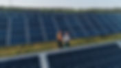
- Drone Jobs in North Carolina 2025
The drone industry in North Carolina is fueled by progressive regulations, a startups, and a growing demand for skilled professionals across a wide range of industries. As the Tar Heel State cements its reputation as a national leader in unmanned aerial systems (UAS), opportunities for drone pilots, technicians, data analysts, and innovators are expanding rapidly. Let's explore the current landscape of drone jobs in North Carolina, highlighting emerging sectors, salary prospects, required skills, and drone building cleaning. Table of Contents NC Drone Tech Key Industries Jobs & Salaries Skills & Certifications Drone Building Cleaning Whether you’re considering a career change, seeking a side gig, or exploring entrepreneurial opportunities, North Carolina’s dynamic drone market offers something for everyone. North Carolina Drone Technology North Carolina has emerged as a powerhouse in the drone industry, thanks to forward-thinking policies and a supportive environment for innovation. The state recently made headlines by repealing its state-specific drone operator permit requirement , streamlining the regulatory process for commercial and government operators. This change, enacted through House Bill 198, aligns North Carolina with federal standards and reduces bureaucratic hurdles, making it easier for businesses and individuals to operate drones for a variety of applications. The state’s commitment to innovation is further reflected in its partnerships with leading drone companies such as Zipline and Wing , which are delivering medical supplies and food to remote communities. North Carolina’s legacy in aviation continues to inspire a new generation of pioneers in unmanned flight. The state’s universities, including UNC-Chapel Hill and Elizabeth City State University are also at the forefront of drone research, training, and workforce development, ensuring a steady pipeline of talent for the industry. Key Industries Hiring Drone Professionals North Carolina’s drone industry is characterized by its diversity, with demand for skilled operators in sectors ranging from public safety and agriculture to construction, real estate, and energy. Public safety agencies across the state are increasingly relying on drones for search and rescue, disaster response, traffic management, and crime scene investigation. For example, the Charlotte- Mecklenburg Police Department has used drones to track suspects and manage crowds, while the North Carolina Department of Transportation (NCDOT) leverages UAVs for infrastructure inspections and disaster recovery. Agriculture Agriculture remains a cornerstone of the state’s economy, and drones are playing a transformative role in modernizing farming practices. Farmers use UAVs for precision agriculture, monitoring crop health, soil moisture, and pest activity, which helps optimize resources and increase yields. Construction and Infrastructure Drones are transforming the construction and infrastructure sectors in North Carolina by delivering detailed aerial data that enhances project accuracy and safety. With UAVs, construction teams can create topographic maps, monitor earthwork progress, and generate 3D models of job sites , all without disrupting ongoing operations. This technology not only streamlines project management but also enables real-time collaboration between field crews and project managers, who can access up-to-date imagery and data from anywhere. The use of drones for inspecting bridges, roads, and power lines is also reducing the need for risky manual inspections, helping companies comply with regulatory standards while minimizing downtime and costs. As more firms adopt drone solutions, North Carolina is seeing greater efficiency and innovation in infrastructure development, positioning the state as a leader in modern construction practices. Photography & Videography The demand for aerial content has led to a surge in specialized services, with drone operators collaborating closely with real estate agents, tourism boards, and event organizers to deliver perspectives that were once impossible or cost-prohibitive. In North Carolina, businesses are increasingly leveraging drone photography and videography to showcase properties, document construction progress, and create promotional materials that stand out. This trend is not limited to commercial projects - individuals are also hiring licensed drone pilots for weddings, sporting events, and community festivals, fueling the freelance market. As regulations evolve and technology advances, North Carolina’s creative professionals are finding new ways to push the boundaries of visual storytelling, making drone-enabled imagery an essential tool for marketing and communication across the state. Energy Utility companies are deploying UAVs equipped with thermal and multispectral sensors to detect faults in power lines and solar arrays before they escalate into costly outages. This proactive approach enables faster repairs and minimizes service disruptions for customers. In the renewable energy space, drones are used to inspect solar farms and wind installations, providing detailed imagery and data that help optimize energy production and ensure regulatory compliance. Additionally, when environmental incidents such as fuel spills or storm damage occur, drones assist in rapid assessment and logistics planning for cleanup operations, reducing response times and improving safety for ground crews. As these technologies evolve, the demand for skilled drone professionals in North Carolina’s energy sector continues to grow, supporting both traditional utilities and the state’s expanding portfolio of renewable Drone Job Opportunities and Salary Expectations The job market for drone professionals in North Carolina is robust, with dozens of positions available across the state. Job boards such as Indeed and ZipRecruiter regularly list openings for drone pilots, inspectors, surveyors, and technicians. Entry-level roles, such as part-time drone operators for public safety teams or freelance photographers, offer flexible schedules and competitive pay, while more specialized positions, such as infrastructure inspectors or LiDAR mapping specialists, command higher salaries and require advanced certifications. The average annual salary for a drone pilot in North Carolina is approximately $70,000, with top earners making over $85,000 per year. Freelance drone pilots and videographers can also earn competitive rates, particularly in real estate and media, where project-based work is common. The most sought-after skills for drone jobs include pilot proficiency, photography and videography, data analysis, and familiarity with industry-specific software. Employers also value experience with regulatory compliance, as all commercial drone operations must adhere to FAA Part 107 rules. Required Skills and Certifications for Drone Jobs Raleigh, North Carolina Airspace To succeed in North Carolina’s drone job market, professionals must possess a combination of technical and soft skills. The most common educational background among drone pilots is a high school diploma or GED, although vocational training, associate degrees, and even bachelor’s degrees are increasingly common. Experience levels vary, with most professionals having between two and four years of hands-on experience. Technical skills include pilot proficiency, with mastery of drone flight operations such as takeoff, landing, navigation, and emergency procedures. Photography and videography skills are essential for those working in real estate, media, and marketing, as high-quality aerial images and videos are in high demand. Data analysis skills are also important, as many drone jobs involve processing and interpreting data collected during flights, such as crop health maps or infrastructure inspection reports. Familiarity with industry-standard software for flight planning, data processing, and image editing, such as Adobe Premiere, Pix4D, and DroneDeploy, is highly valued. Regulatory knowledge is a must, as all commercial drone operations must comply with FAA Part 107 regulations, airspace restrictions, and safety protocols. Soft skills such as communication, problem-solving, and customer service are equally important, especially for professionals working directly with clients or as part of multidisciplinary teams. Certification is a must for commercial drone pilots. The FAA Part 107 Remote Pilot Certificate is the industry standard, requiring applicants to pass a written exam on aviation knowledge, regulations, and safety procedures. Additional certifications, such as those for advanced flight operations or specialized equipment, can further enhance career prospects. Drone Building Cleaning: A High-Growth Niche One of the most exciting and rapidly growing niches in North Carolina’s drone industry is drone building cleaning. This innovative application uses heavy-lifting drones equipped with advanced spraying systems to clean windows, facades, roofs, and other exterior surfaces of commercial and residential buildings. The benefits are clear: increased safety, reduced labor costs, and faster project completion times compared to traditional methods. Companies like Lucid Bots and VSI Aerial are leading the way in this field, offering specialized drone cleaning services for high-rise buildings, hospitals, hotels, and office complexes. Lucid Bots, based in Charlotte, has gained national recognition for its flagship Sherpa cleaning drone, which is capable of handling large-scale industrial cleaning projects with ease. The Sherpa drone can complete jobs that once required a crew of eight workers and $150,000 in expenses in a fraction of the time and at a fraction of the cost, making it an attractive option for cleaning businesses and property managers. Drone building cleaning is revolutionizing the maintenance industry by eliminating the need for ladders, scaffolding, and manual high-access equipment. This not only reduces the risk of workplace accidents but also allows for more efficient and cost-effective cleaning of hard-to-reach areas. For example, traditional cleaning costs can be 25% to 50% higher per square foot compared to drone cleaning services, thanks to reduced labor and lower insurance costs. Drones can also cover extensive areas of a building’s facade much quicker than traditional methods, minimizing disruption to occupants and maximizing efficiency. The job market for drone building cleaning is expanding rapidly, with positions available for licensed drone pilots, technicians, and sales representatives. Companies are seeking candidates with FAA Part 107 certification, mechanical aptitude, and a commitment to safety and compliance. On-the-job training is often provided, making this an accessible entry point for those new to the drone industry. Compliance with FAA regulations, airspace restrictions, and local permit requirements is essential for all commercial drone cleaning operations. Drone pilots must hold a valid FAA Remote Pilot Certificate under Part 107, and companies must carry appropriate insurance and permits to protect both workers and clients. Safety is a top priority, with strict protocols in place to ensure the well-being of operators, bystanders, and property. The future of drone building cleaning in North Carolina is bright, with increasing demand from property managers, building owners, and facility managers seeking safer, faster, and more cost-effective solutions for exterior maintenance. As the technology continues to evolve, new opportunities will emerge for skilled professionals in this high-growth niche. Conclusion Driven by progressive regulations, innovative startups, and a diverse range of applications across public safety, agriculture, construction, real estate, and energy. The state’s streamlined policies, partnerships with industry leaders like Zipline and Wing, and advancements in niches like drone building cleaning have positioned North Carolina as a national hub for drone technology, creating a wealth of opportunities for pilots, technicians, and entrepreneurs. With competitive salaries, accessible certifications like the FAA Part 107, and a supportive ecosystem for workforce development, the Tar Heel State offers a promising landscape for those looking to build a career in this high-tech field.
- Exploring the Range of Drone Services in 2025
Drones have transformed from niche gadgets into essential tools across many industries. Their ability to capture aerial views, collect data, and perform tasks remotely has opened new possibilities. Today, modern drone services offer a wide array of applications that improve efficiency, safety, and creativity. The Evolution and Scope of Modern Drone Services Modern drone services have evolved rapidly over the past decade, transforming from a niche hobby into a pivotal tool across various industries. Initially popular for recreational use, where enthusiasts would fly drones for fun or to capture stunning aerial photographs, drones have now expanded their utility to serve an array of professional purposes in sectors such as agriculture, construction , real estate, filmmaking, and beyond. This evolution has been driven by significant advancements in technology, which have enabled drones to incorporate high-resolution cameras, thermal imaging capabilities, LiDAR sensors, and sophisticated autonomous flight features that enhance their functionality and efficiency. These technological developments have empowered drones to perform a wide range of complex tasks that were previously time-consuming, labor-intensive, or even hazardous. For example, drones can now: Surveying large land areas quickly and accurately, allowing for efficient mapping and land assessment. This capability is particularly beneficial in real estate and urban planning, where precise topographical data is essential for development projects. Inspecting infrastructure like bridges, power lines, and wind turbines without risking human safety. Drones equipped with advanced sensors can detect structural weaknesses and maintenance needs, thus improving safety and reducing costs associated with traditional inspection methods. Monitoring crop health and irrigation in precision agriculture, enabling farmers to assess the condition of their fields in real-time. By using drones equipped with multispectral cameras, farmers can identify areas that require attention, optimize water usage, and increase overall yield. Capturing cinematic footage for marketing and entertainment, providing filmmakers and advertisers with unique perspectives that enhance storytelling and visual appeal. Drones have revolutionized the way aerial shots are captured, making it more accessible and cost-effective for various productions. The versatility of drones is a key factor in their growing popularity and application across different industries. Their ability to be customized with various payloads and software solutions means that they can be tailored to meet specific operational needs. For instance, a drone used in environmental monitoring can be equipped with different sensors to track air quality or wildlife populations, while a drone used in construction might carry a high-resolution camera for site documentation and progress tracking. Furthermore, the integration of drones into business processes is not just about replacing traditional methods but also about creating new opportunities for innovation and growth. As companies begin to understand the potential of drone technology, they are finding novel applications that enhance their competitive edge and drive industry advancements. Key Applications of Modern Drone Services Understanding the practical applications of drone services helps illustrate their value. Here are some of the most common and impactful uses: Agriculture Farmers use drones to monitor crop health, identify pest infestations, and optimize irrigation. Equipped with multispectral cameras, drones can detect plant stress invisible to the naked eye. This data enables targeted interventions, reducing costs and increasing yields. Construction and Infrastructure Drones provide aerial surveys and 3D mapping of construction sites. They help track progress, identify safety hazards, and inspect hard-to-reach areas like rooftops and towers. This reduces the need for manual inspections and accelerates project timelines. Real Estate and Marketing Real estate agents and marketers use drones to capture stunning aerial photos and videos of properties. These visuals enhance listings and promotional materials, attracting more potential buyers or clients. Environmental Monitoring Drones assist in wildlife monitoring, forest management, and disaster response. They can access remote or dangerous locations, providing real-time data to researchers and emergency teams. Film and Media Production Filmmakers rely on drones for dynamic aerial shots that were once costly or impossible. The ability to program precise flight paths allows for creative storytelling and unique perspectives. What is a drone service? A drone service refers to the professional use of unmanned aerial vehicles (UAVs) to perform specific tasks for clients. These services are typically offered by companies or individuals who operate drones equipped with specialized technology. The goal is to provide actionable data, imagery, or other deliverables that support decision-making or enhance projects. Drone services can include: Aerial photography and videography Surveying and mapping Inspection and monitoring Delivery and logistics (in some cases) Data analysis and reporting Operators must comply with aviation regulations and ensure safe flight practices. Many drone service providers also offer consultation to help clients determine the best drone solutions for their needs. How to Choose the Right Drone Service Provider Selecting the right drone service provider is crucial for achieving your project goals. Here are some factors to consider: Experience and Expertise Look for providers with a proven track record in your industry. Experienced operators understand the nuances of different applications and can deliver reliable results. Technology and Equipment Ensure the provider uses up-to-date drones and sensors suitable for your requirements. For example, thermal imaging is essential for certain inspections, while high-resolution cameras are key for marketing. Compliance and Safety Verify that the company follows all local regulations and holds necessary certifications. Safety protocols protect both the operator and the public. Data Processing Capabilities Some projects require advanced data analysis. Choose a provider who can process and interpret the collected data effectively. Customer Support and Communication Good communication ensures your needs are understood and met. Responsive providers can adapt to changes and provide timely updates. By carefully evaluating these aspects, you can partner with a drone service provider that adds real value to your operations. The Future of Drone Services and Emerging Trends The future of drone services looks promising, with ongoing innovations expanding their potential. Some emerging trends include: Autonomous Flight and AI Integration : Advances in artificial intelligence enable drones to fly and make decisions independently, significantly increasing operational efficiency, enhancing safety protocols, and reducing human error, which ultimately leads to more reliable and effective aerial operations in various industries. Swarm Technology : Coordinated groups of drones working together can cover larger areas or perform complex tasks faster, allowing for increased efficiency and effectiveness in various applications such as agriculture, search and rescue operations, and environmental monitoring. Expanded Delivery Services : While still in the early stages of development and implementation, drone delivery is gaining significant traction for transporting a variety of essential items, including medical supplies, food, and small packages, thereby revolutionizing the logistics and delivery industry by providing faster and more efficient service options. Improved Battery Life and Payload Capacity : With extended flight times and the ability to carry heavier payloads, drones will be equipped to handle more demanding jobs, such as delivering larger packages, conducting extensive aerial surveys, and performing complex agricultural tasks that require sustained operation and greater efficiency. Advanced Data Analytics : By integrating with cloud computing and machine learning, more profound insights can be derived from data collected by drones, enabling businesses and researchers to make informed decisions, optimize operations, and uncover patterns that were previously hidden in vast datasets. Staying informed about these trends can help businesses leverage drone services to maintain a competitive edge. Exploring the range of drone services reveals how this technology is reshaping industries. Whether for capturing breathtaking visuals, conducting precise surveys, or monitoring critical infrastructure, drones offer practical solutions that save time and resources. As the technology continues to advance, the possibilities for drone applications will only grow, making it an exciting field to watch and utilize.
- The Impact of Drones on Real Estate: Transforming Commercial and Residential Markets
Table of Contents Real Estate Agents Sellers & Homeowners Marketing Professionals Developers & Brokers Inspectors & Adjusters The Future Conclusion Let's explore... Real Estate Agents Commercial Real Estate Commercial real estate agents rely on drones to showcase expansive properties. These include office parks, warehouses, and retail centers. Aerial views capture essential details like parking lots, access roads, and proximity to highways. This information helps prospective tenants and investors assess usability and value effectively. Drones document a building’s relationship to surrounding businesses and regional infrastructure. This documentation supports negotiations with corporate tenants and strategic investment partners. Agents use these visuals for digital tour packages, investor presentations, and global marketing. This often makes commercial properties accessible to international audiences who cannot visit in person. Residential Real Estate Residential agents use drones to highlight property attributes. These include lot size, landscaping, and neighborhood features like parks and schools. Listings with aerial imagery tend to attract more attention and sell faster. Today's buyers expect immersive, high-quality visuals when browsing for a home. Drones provide buyers with unique perspectives. They allow potential homeowners to understand a home’s setting, privacy, and curb appeal. This frequently boosts engagement and viewings. Integrating drone imagery into marketing materials enhances agents' reputations as forward-thinking professionals ready to serve modern clients. Sellers & Homeowners Commercial Real Estate Owner-sellers of commercial properties use drones to spotlight recent improvements. These improvements may include new roofing, parking expansions, or green landscaping. Aerial views can reveal property boundaries, available building footprints, and access points. All of these details are essential for attracting qualified buyers or tenants. Sellers benefit from providing prospective investors with digital site visits. This helps streamline decision-making and negotiations. For businesses exiting a property, drone documentation of overall site condition can support asset transfer and legal record-keeping. Residential Real Estate Homeowners selling their residence use drones to capture homes in ideal lighting or during visually appealing seasons. This gives a true sense of atmosphere and space. Aerial shots highlight gardens, backyards, pool placements, and special features like outdoor living spaces or paths connecting to nearby amenities. Drones give sellers a way to display lot shape, privacy from neighbors, and recent exterior upgrades. This appeals to buyers searching online. These visuals can result in more qualified showings and competitive offers. Buyers arrive with a clearer understanding of the property's features. Marketing Professionals Commercial Real Estate Real estate marketing agencies utilize drone footage for branding campaigns. This includes B2B presentations and site-selection content that reach corporate decision-makers. They produce high-quality aerial videos and interactive site maps for digital brochures, corporate websites, and tradeshow displays. Marketers use drones to build compelling narratives around commercial developments. This often incorporates 3D mapping and time-lapse features. These assets support brokers in global marketing, bridging the gap for remote partnerships, international investors, or institutional stakeholders. Residential Real Estate Residential marketers combine drone imagery with traditional photography. This creates visually rich home listings, social ads, and landing pages. Short aerial videos are increasingly common on social media. They attract interest from mobile-first, tech-savvy buyers. Drones allow marketers to tailor promotional material to buyers relocating from a distance. They highlight not just the home, but also its surrounding neighborhood and amenities. Property-focused ad campaigns, boosted by drone visuals, help agencies and agents stand out in crowded marketplaces. Developers & Brokers Commercial Real Estate Developers and commercial brokers use drones to document land condition, depth, and usable space. This occurs during site selection and feasibility studies. Aerial imagery reveals traffic flow, parking logistics, and immediate competition. It also shows access to transportation or utilities, supporting business case development for new builds or redevelopments. Drones simplify progress monitoring for multi-phase construction. They allow teams and investors to review milestones remotely and address issues promptly. Visual site reports, including 3D models and GIS data, streamline regulatory reviews, permitting, and internal communication among project partners. Residential Real Estate Residential developers use drones for marketing new subdivisions, model homes, and phased communities. They highlight street layouts, pathways, and communal spaces. Brokers leverage aerial visuals to position their properties against local competition. They showcase access to community amenities or emphasize unique site features. Drones provide up-to-date imagery for use in sales centers, informative brochures, and digital campaigns. This helps buyers visualize the investment potential and lifestyle offered by a property. Developers utilize drone photos for land surveys, resource planning, and generating accurate as-built documentation for public agencies or homeowner associations. Inspectors & Adjusters Commercial Real Estate Inspectors working on commercial properties deploy drones to examine expansive or hazardous areas. This includes rooftops, facades, and hard-to-reach structures. Drones reduce risk and increase thoroughness. They are used for regular maintenance inspections, safety compliance, and property assessments following weather events or during routine insurance audits. Adjusters can quickly assess property conditions. They document storm or fire damage and validate claims with high-resolution aerial evidence. This reduces claim resolution times and minimizes business interruptions. Aerial documentation supports more accurate insurance underwriting, risk management, and portfolio oversight for large-scale commercial assets. Residential Real Estate For residential inspections, drones safely capture roof conditions and chimney integrity. They evaluate areas inaccessible by ladder, helping identify issues before they worsen. Insurance adjusters leverage drone images for quick and complete recording of property status after storms, fires, or accidents. This allows for faster and fairer claims processing. Drones improve fraud detection by comparing pre- and post-incident imagery. They aid in premium adjustments by providing detailed, up-to-date views of the home and lot. This approach delivers more transparency and peace of mind for homeowners. It ensures that evaluations are supported by visual documentation rather than solely on-site notes. The Future of Drone Technology in Real Estate As drone technology continues to evolve, its applications in real estate will expand. I anticipate that drones will become even more integrated into the real estate process. From virtual reality tours to enhanced data analytics, the future looks promising. Innovations like AI-driven drones could analyze property conditions in real-time. This would provide even more valuable insights for buyers, sellers, and agents. The potential for drones to revolutionize how we view and interact with real estate is immense. Moreover, as regulations around drone usage become clearer, more professionals will adopt this technology. This will lead to a more standardized approach to aerial photography and documentation in the industry. Conclusion Drones are now an indispensable tool for professionals across the commercial and residential real estate spectrum. Whether optimizing listings for busy agents, equipping marketing teams with engaging content, assisting developers in site planning and construction, empowering sellers with clearer visuals, or supporting inspectors with safe, detailed documentation, drone technology delivers value at every step. As adoption accelerates and capabilities expand, drones are set to continue elevating standards and outcomes in both commercial and residential real estate for years to come.
- Drone Construction Site Imagery: Who Uses It and Why?
Table of Contents Project Managers Surveyors & Engineers Architects & Designers Excavation Contractors Marketing & Sales Let's explore... Project Managers Project managers leverage drone imagery to monitor construction progress with a level of detail and frequency that traditional methods cannot match. By scheduling regular drone flights using waypoints and geotagging, project managers obtain consistent, high-resolution photos and videos from the same angles each time, allowing for accurate visual comparisons over days, weeks, or months. For example, platforms like DroneDeploy enable the creation of visual timelines and weekly progress reports, making it easy to spot delays or deviations from the schedule and to verify that subcontractors are meeting their milestones. Drones also facilitate real-time data collection and reporting. Project managers can use aerial maps and 3D models generated from drone data to measure the actual progress of earthworks, concrete pours, or structural installations against the project plan. For instance, if a drone survey reveals that a foundation is only 70% complete when it should be finished, managers can intervene early, adjust resources, and communicate updates to stakeholders, helping to prevent costly overruns and keep the project on budget. Additionally, drones allow for efficient material and stockpile tracking, which directly impacts budget management. Drones can quickly measure the volume of materials on-site, such as gravel or soil, ensuring that deliveries match invoices and that resources are used efficiently. This reduces the need for manual labor, minimizes errors, and helps project managers make informed decisions to keep both schedules and budgets on track. Surveyors & Engineers Surveyors and engineers use high-resolution images and topographic data from drones to create highly accurate 2D maps, 3D models, and digital elevation models (DEMs) for precise site planning and design. For example, drones can quickly capture detailed aerial photos of a construction site, which are then processed into orthomosaic maps that provide an up-to-date, true-to-scale view of the entire area - these maps are essential for laying out building footprints, roads, and utilities with exact measurements. Additionally, drones equipped with LiDAR or photogrammetry can generate 3D terrain models; engineers use these to calculate earthwork volumes, plan grading, and identify drainage patterns, ensuring that site designs account for real-world elevations and slopes. Another example involves earthwork surveys, where drones collect topographic data using ground control points (GCPs) or real-time kinematic (RTK) GPS technology to achieve centimeter-level accuracy. This allows surveyors to precisely measure cut-and-fill requirements, monitor changes over time, and adjust plans as needed, all without the delays and labor costs of manual surveying. The rapid, detailed data collection also enables engineers to conduct virtual site inspections, compare as-built conditions to design models, and resolve discrepancies before they become major issues, ultimately reducing project risk and improving efficiency. Architects & Designers Architects and designers use drone imagery to visualize site conditions, assess terrain, and integrate real-world data into their planning. The detailed aerial images support the creation of 3D models and overlays, allowing for better design decisions and presentations to clients. This helps identify site constraints and optimize building placement before construction begins. By leveraging drone footage, architects can accurately simulate environmental factors like sunlight exposure and flood risks, leading to more sustainable and resilient designs. High-resolution imagery enables precise measurements and topographic mapping, reducing errors in blueprints and ensuring compliance with zoning regulations. Additionally, it fosters enhanced collaboration with stakeholders by providing immersive visual tools for virtual reality tours and iterative feedback loops. Overall, incorporating drone data streamlines the pre-construction phase, cutting costs associated with rework and accelerating project timelines. Excavation/Earthwork Excavation and earthwork contractors rely on drone imagery to monitor progress, calculate material volumes, and ensure site safety during ground preparation. Aerial views provide real-time data on excavation depths, soil displacement, and terrain alterations, helping contractors adjust operations efficiently. This technology minimizes manual measurements, reducing labor costs and the risk of human error in volumetric assessments. By capturing high-resolution images and creating topographic maps, drones enable precise cut-and-fill calculations, optimizing resource allocation and preventing over-excavation. Contractors can also detect potential hazards like unstable slopes or underground utilities early, enhancing worker safety and compliance with regulations. Furthermore, time-lapse drone footage documents site changes for reporting and dispute resolution, fostering transparency with project stakeholders. Ultimately, integrating drone data into earthwork processes accelerates timelines, improves accuracy, and contributes to more cost-effective project outcomes. Marketing & Sales Marketing and sales teams leverage drone imagery to create compelling visual content for promotional materials, presentations, and listings. High-quality aerial photos and videos showcase project progress, site features, and surrounding amenities, attracting buyers and investors. This visual storytelling enhances brand reputation and marketability. By incorporating dynamic drone footage into virtual tours and social media campaigns, teams can provide immersive experiences that allow potential clients to explore sites remotely, increasing engagement and conversion rates. The ability to highlight unique selling points, such as proximity to infrastructure or environmental integrations, through annotated aerial views strengthens sales narratives and differentiates offerings in competitive markets. Moreover, regular updates via drone-captured time-lapse videos build trust by demonstrating transparency in project milestones, reassuring stakeholders of timely delivery and quality. Conclusion Drone construction site imagery has revolutionized the industry by empowering diverse professionals - from project managers tracking progress and budgets to surveyors and engineers crafting precise models, architects and designers envisioning sustainable plans, excavation contractors ensuring safety and efficiency, and marketing teams captivating audiences with immersive visuals. Across these roles, the common thread is enhanced accuracy, cost savings, and streamlined workflows that minimize risks and maximize outcomes. As drone technology continues to evolve with advancements in AI, automation, and data integration, its adoption will only deepen, fostering even greater innovation and collaboration in construction projects. Ultimately, embracing drone imagery isn't just about capturing views from above - it's about building a smarter, more efficient future for the entire sector.
- How Ai is Improving Drone Inspections in 2025
The integration of artificial intelligence (AI) into drone inspections has rapidly transformed how industries monitor, maintain, and manage critical assets. In 2025, AI equipped drones are not just a futuristic concept - they are a reality delivering unprecedented efficiency, accuracy, and safety across sectors such as solar, wind, agriculture, building maintenance and Infrastructure. Table of Contents Inspections Evolution Renewable Energy Agriculture Buildings & Infrastructure The Future AI is revolutionizing drone inspections , highlighting real-world applications, industry benefits, and the future outlook for drone powered technology. The Evolution of Drone Inspections Drone Facade Inspection of Masonry For decades, building and infrastructure inspections were rooted in traditional, hands-on methods. Inspectors would physically access sites, often requiring ladders, scaffolding, or manual entry into hazardous environments to visually assess conditions and identify issues. This approach was not only time-consuming but also posed significant safety risks, especially when working at heights or in confined spaces. The process was further complicated by the need for specialized equipment and multiple site visits, which could delay projects and increase costs. The introduction of drones marked a pivotal shift in the inspection landscape. Initially, drones were used primarily as aerial cameras, allowing inspectors to capture images and videos of otherwise inaccessible areas without putting themselves in harm’s way. These early drone inspections still relied on manual piloting and required operators to review footage after each flight to identify potential problems. While this method improved safety and efficiency compared to traditional techniques, it remained limited by the need for human intervention at every stage - from flying the drone to analyzing the collected data. As drone technology advanced, the next leap forward came with the integration of artificial intelligence. Modern AI-powered drones can now autonomously navigate inspection sites, capture high-resolution imagery, and process vast amounts of data in real time. AI algorithms are trained to detect, classify, and even predict maintenance needs by analyzing patterns and anomalies within the inspection data. This automation has dramatically increased the speed, accuracy, and scalability of inspections, enabling organizations to monitor assets more frequently and respond proactively to potential issues. AI in Renewable Energy Inspections The renewable energy sector is one of the biggest beneficiaries of AI-powered drone inspections. Solar and wind farms, in particular, require frequent and thorough inspections to ensure optimal performance and longevity. Traditional methods often involve manual checks or ground-based cameras, which are time-consuming and can miss subtle defects. AI-equipped drones, however, can autonomously scan vast solar arrays and wind turbines, capturing high-resolution images and thermal data. In solar energy, AI algorithms analyze images to detect micro-cracks, hot spots, and soiling on panels. These issues can significantly reduce energy output if left unchecked. By identifying problems early, operators can schedule targeted repairs, minimizing downtime and maximizing energy production. Wind energy is another sector where AI and machine learning drones are making a major impact. Inspecting wind turbine blades is challenging due to their height and the need for close-up visual assessment. AI-powered drones can autonomously navigate around turbines, capturing high-definition images and identifying defects such as cracks, erosion, or lightning damage. This not only improves safety by reducing the need for technicians to climb turbines but also enhances inspection accuracy. AI in Agriculture Inspections Agriculture is experiencing a revolution thanks to AI-powered drone inspections. Farmers and agronomists now rely on drones equipped with multispectral and hyperspectral cameras to monitor crop health, detect pests, and assess soil conditions. AI algorithms process this data to generate actionable insights, such as identifying areas of nutrient deficiency, water stress, or disease outbreaks. For instance, AI can distinguish between healthy and diseased plants by analyzing subtle differences in texture that are invisible to the naked eye. This enables farmers to apply fertilizers, pesticides, or irrigation only where needed, reducing waste and environmental impact. Companies AgEagle provide AI-driven drone solutions for precision agriculture, helping farmers increase yields and improve sustainability. AI-powered drones also play a crucial role in soil monitoring . By analyzing aerial imagery, AI can map soil moisture levels, detect erosion, and assess the impact of weather events. This information helps farmers optimize planting schedules, manage irrigation, and prevent soil degradation. The result is a more efficient, sustainable, and profitable farming operation. AI in Building Maintenance & Infrastructure Inspections Walmart Roof and Facade Inspection Building maintenance and infrastructure inspections are another area where AI-powered drones are delivering significant benefits. Traditional methods often require scaffolding, lifts, or manual inspections, which are costly, time-consuming, and pose safety risks. AI-enabled drones can autonomously inspect building facades, roofs, bridges, and other structures, capturing high-resolution images and identifying defects such as cracks, corrosion, or water damage. Walmart Roof Inspection In the building maintenance sector, AI-powered drones are increasingly used for window cleaning, façade inspections, and roof assessments . These drones can detect issues that might be missed during manual inspections, such as subtle cracks or early signs of wear. By providing detailed, real-time data, AI-powered drones enable property managers to prioritize repairs, extend asset lifespans, and reduce maintenance costs. For example, companies like Lucid Bots are pioneering AI-driven drone solutions for building maintenance, offering safer and more efficient alternatives to traditional methods. Infrastructure inspections have also improved with the use of AI by enabling the rapid collection and processing of high-resolution images and sensor data from bridges , roads, and railways. Advanced AI algorithms automatically detect and classify structural defects - such as cracks, corrosion, and misalignments - with greater accuracy and speed than traditional manual methods. By continuously monitoring infrastructure conditions and predicting potential failures, these systems allow authorities to prioritize maintenance tasks, address issues before they worsen, and ultimately extend the lifespan of critical assets while minimizing both safety risks and operational costs. The Future of AI in Drone Inspections The future of AI in drone inspections is bright, with ongoing advancements in machine learning, computer vision, and autonomous navigation. As AI algorithms become more sophisticated, they will be able to detect increasingly subtle defects, predict maintenance needs, and even recommend repair strategies. This will further reduce the need for human intervention, lower costs, and improve safety across industries. One promising trend is the integration of AI with other emerging technologies, such as the Internet of Things (IoT) and 5G connectivity. This will enable real-time data sharing and collaboration between drones, sensors, and centralized management systems. For example, a drone inspecting a solar farm could instantly share findings with a maintenance team, who could then address issues immediately. This seamless integration will make asset management more efficient and responsive. Another area of growth is the use of AI-powered drones for environmental monitoring and disaster response. Drones equipped with AI can quickly assess damage after natural disasters, monitor pollution levels, and track wildlife populations. This will be invaluable for conservation efforts, emergency response, and sustainable development. Conclusion AI is making drone inspections faster, safer, and more accurate across a wide range of industries. From renewable energy and agriculture to building maintenance and infrastructure, AI-powered drones are setting new standards for efficiency and reliability. As technology continues to evolve, the possibilities for AI in drone inspections are virtually limitless, promising a future where asset management is smarter, safer, and more sustainable than ever before.
- 4 Leading Drone Innovations in Construction Site Management
The construction industry is experiencing a technological renaissance, with drones emerging as the cornerstone of modern site management. By 2025, these innovations have evolved from experimental tools to mission-critical assets, transforming efficiency, safety, and decision-making. Table of Contents Heavy Equipment Integration On-Site Auto Drone Mapping & 3D Modeling Real-Time Analysis Let's explore 4 pivotal drone advancements redefining construction - tracking their origins and detailing their current capabilities in 2025. Heavy Equipment Integration The integration of drones with heavy equipment in the construction industry began to take shape in the mid-2010s, when innovators like Komatsu started using UAVs to guide earthmoving operations . Early systems primarily relied on drone-captured aerial imagery to help operators make better decisions, reducing the need for manual surveys and increasing both speed and safety on site. By 2025, this technology has matured into a fully connected and largely autonomous ecosystem, where drones and heavy machinery communicate seamlessly to complete earth moving and material delivery tasks. Modern drones equipped with high-resolution cameras, LiDAR, and GPS now provide real-time topographic data directly to autonomous bulldozers, excavators, and graders. This allows for precise grading, digging, and material placement, with adjustments happening dynamically as conditions change. For example, Komatsu’s partnership with Nvidia and SkyCatch has resulted in advanced platforms where drone-generated 3D maps and terrain models are processed by AI, enabling heavy equipment to operate with centimeter-level accuracy and improving both efficiency and site safety. These systems can even track the movement of workers and machinery, minimizing the risk of accidents and ensuring compliance with safety protocols. Caterpillar and other industry leaders have also embraced this integration, deploying fleets of autonomous vehicles that leverage drone data for optimal performance on large-scale projects. The use of drones in earthmoving operations has been shown to reduce unplanned costs, cut rework, and significantly improve project timelines. Heavy lift drones are now capable of transporting materials to hard-to-reach locations, complementing traditional equipment and further streamlining construction workflows. This shift to drone-guided heavy equipment is especially valuable in challenging terrains, where real-time aerial data ensures that grading and excavation are executed with unmatched precision. The result is a dramatic reduction in fuel consumption, shortened earthwork timelines, and a safer, more efficient jobsite. As drone and heavy equipment integration continues to advance, it is rapidly becoming the industry standard for modern, data-driven construction management. On-Site Autonomous Drones: Drone-in-a-Box The concept of “drone-in-a-box” technology traces its origins to military research in the late 1960s, but it wasn’t until the late 2010s that commercial breakthroughs made fully autonomous deployments possible. Early solutions were limited by high costs and technical barriers, but by 2017, companies like Airobotics demonstrated true autonomy, allowing drones to launch, land, recharge, and execute missions without human intervention. By 2025, these systems have become indispensable on construction sites, with platforms such as Percepto and DJI’s Dock series enabling round-the-clock aerial operations. These automated drones are programmed to perform scheduled safety inspections at sunrise, monitor site activity throughout the day, and conduct security sweeps at night, all while automatically returning to their weatherproof stations for charging and data upload. This level of automation has slashed manual inspection labor by as much as 70%, delivering a constant stream of actionable data that was previously unattainable. The evolution of drone-in-a-box technology has been marked by significant advancements in durability, intelligence, and flexibility. Modern systems are engineered to operate in extreme environments, with features like IP55 and IP56 weather resistance, integrated environmental monitoring, and rapid charging capabilities that ensure minimal downtime between missions. For instance, DJI’s Dock 2 and Dock 3 solutions are designed to withstand temperatures ranging from -35°C to 50°C and can be deployed in remote or hazardous locations where manual drone operation would be impractical or unsafe. Their ability to launch in as little as 10 seconds and support mission planning through cloud-based platforms like FlightHub 2 allows construction managers to schedule, monitor, and adapt drone operations from anywhere, maximizing both safety and efficiency on site. A major leap forward in 2025 is the introduction of DJI’s Dock 3, which is not only rugged and weatherproof but also vehicle-mountable, enabling mobile and large-scale construction environments to benefit from continuous aerial coverage. The Dock 3 supports the new DJI Matrice 4D and 4TD drones, which are equipped with advanced sensors and anti-ice propellers for reliable operation even in harsh weather conditions. With an operational radius of up to 10 kilometers and seamless integration into cloud management systems, DJI’s drone-in-a-box solutions empower construction teams to automate routine inspections, monitor progress in real time, and respond instantly to site incidents—all without the need for on-site pilots. As a result, drone-in-a-box technology is rapidly becoming the backbone of data-driven, resilient, and highly efficient construction site management. Mapping & 3D Modeling The leap from manual, labor-intensive surveys to instant digital twins has completely transformed how construction teams approach site planning and management. In the past, creating accurate site maps required days of ground-based measurements, followed by hours of photogrammetry processing and manual data stitching. Now, drones equipped with advanced LiDAR and multispectral sensors can fly over a site and deliver highly detailed 3D models. These models are so precise that they capture not only the contours of the terrain but also the location and dimensions of structures, utilities, and even temporary site features. This instant access to up-to-date site information allows project managers and engineers to make informed decisions on the fly, reducing the risk of costly mistakes and project delays. The integration of real-time mapping has enabled construction teams to respond immediately to site changes, such as unexpected grading shifts or weather impacts, keeping projects on track and within budget. Beyond the immediate benefits of speed and accuracy, the integration of drone mapping data with Building Information Modeling (BIM) platforms has unlocked new levels of collaboration and transparency. With digital twins that update dynamically as work progresses, all project stakeholders - from architects and engineers to investors and owners - can access a single, authoritative source of truth. This shared data environment allows for the overlay of design plans onto real-world conditions, making it easy to spot discrepancies and resolve them before they escalate. For example, if a drone-captured model reveals that a foundation is being poured out of alignment, the issue can be flagged and corrected in real time, rather than after costly rework is required. Industry leaders like Autodesk and Pix4D have developed cloud-based platforms that streamline this process, enabling seamless uploads, analysis, and sharing of drone-generated 3D models. As a result, construction projects are not only more efficient but also more transparent and accountable, with every change documented and accessible at any stage of the build. Real-Time Data Analysis The ability to analyze drone data in real time has fundamentally changed how construction teams manage quality, safety, and efficiency on site. With edge computing and 5G connectivity, drones now process and transmit thermal, multispectral, and high-resolution visual data directly to cloud-based platforms as they fly. Artificial intelligence then sifts through this data, instantly flagging anomalies like heat leaks, moisture intrusion, or structural misalignments that would have previously required hours of manual inspection and post-processing. This immediate feedback loop empowers project managers to intervene at the first sign of trouble - halting crane operations if unstable ground is detected, rerouting deliveries to avoid congestion, or deploying crews to address emerging hazards before they escalate. As a result, construction firms are seeing a substantial reduction in costly rework and delays. Beyond risk detection, real-time drone analysis is driving smarter resource allocation and streamlined workflows across the construction lifecycle. By continuously monitoring site activity and progress , AI-powered platforms can identify bottlenecks, optimize crew deployment, and adjust schedules dynamically to keep projects on track. For example, if drone data reveals that excavation is ahead of schedule while concrete pouring is lagging, managers can quickly reassign resources or adjust deliveries to balance progress. This level of operational agility was unthinkable just a few years ago but is now becoming standard practice on leading-edge projects. Conclusion In 2025, drones have solidified their role as transformative tools in construction site management, driving unprecedented levels of efficiency, safety, and precision. The four leading innovations - heavy equipment integration, on-site autonomous drones, mapping and 3D modeling, and real-time data analysis - have redefined how projects are planned, executed, and monitored. By enabling seamless communication between drones and machinery, providing continuous aerial oversight, delivering instant digital twins, and offering actionable insights through AI, these advancements have turned construction sites into data-driven ecosystems. As adoption continues to grow, drones are not only reducing costs and timelines but also fostering safer, more transparent, and collaborative workflows. The future of construction lies in harnessing these technologies to build smarter, faster, and more sustainably, cementing drones as indispensable assets in the industry’s ongoing technological evolution.